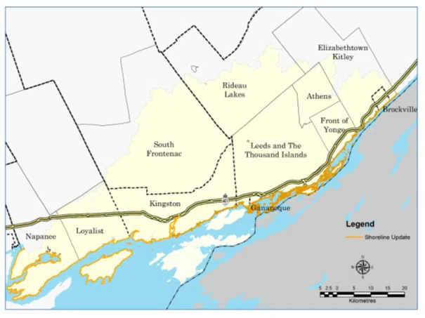
Updating of the flood hazard mapping is in the early stages by Cataraqui Conservation.
Mapping updates are for the Lake Ontario/St. Lawrence River shoreline from Napanee to Brockville, which includes the Lower Cataraqui River below Kingston Mills.
The updates may also be used by municipalities when updating an Official Plan and Zoning By-law schedules as well as review of development applications under the Planning Act.
They would like to hear your feedback and an open house will take place at the Little Cataraqui Creek Conservation Area Outdoor Center on Perth Road in Glenburnie, Wednesday February 7th from 4 to 7pm.
A virtual session will run Thursday February 8th from 7 until 8:30pm.
Registration information can be found below:
Lake Ontario / St. Lawrence River Flood Hazard Mapping Update Walk-in Open HouseLittle Cataraqui Creek Conservation Area Outdoor Centre1641 Perth RoadGlenburnie, ON
Wednesday, February 7, 20244:00 to 7 pmLake Ontario / St. Lawrence River Flood Hazard Mapping Update Virtual Open HouseThursday, February 8, 20247:00 to 8:30 pm (presentation at 7:10 pm)
Please register by contacting Donna Campbell at dcampbell@crca.ca.
